« Find Destination
| Background
| About Us
| Contact Us »
« Time Line
| Symbols | Credits »
«Black Cultural Centre | Nova Scotia Tourism »
« Find Destination »
Find by A - Z Listing
- museums, archives & memorial sites
- dining establishments
- historic sites
« other notable spots »
![]() site on map [contact us to order map]
site on map [contact us to order map]
Other Notable Spots [ a-z listing ]
![]() (06) Beechville Beechville United Baptist Church, Highway 3 then Church Road - Formerly Beech Hill. Find Beechville United Baptist Church, Church Road near Lovett Lake (org. 1844), rebuilt (1879), and Community Centre - a former School for African Nova Scotians.
(06) Beechville Beechville United Baptist Church, Highway 3 then Church Road - Formerly Beech Hill. Find Beechville United Baptist Church, Church Road near Lovett Lake (org. 1844), rebuilt (1879), and Community Centre - a former School for African Nova Scotians.
![]() (13) Boylston Highway 16 - Early Black Loyalist population existed here. Breathtaking view of Chedabucto Bay and the harbour seen from atop the hill of Boylston Provincial Park. Picnic and camping facilities.
(13) Boylston Highway 16 - Early Black Loyalist population existed here. Breathtaking view of Chedabucto Bay and the harbour seen from atop the hill of Boylston Provincial Park. Picnic and camping facilities.
& (13) Manchester
- area of Black Loyalist descendant settlement concentration. Quaint, quiet town.
![]() (34) Centreville - North Street Chapel, Highway 101, 55 North Street
(34) Centreville - North Street Chapel, Highway 101, 55 North Street
- No longer in use as a church. In the family of churches of Delap's Cove, Lequille and Granville Ferry.
![]() (32) Delaps Cove Off of Highway 1
(32) Delaps Cove Off of Highway 1
- 18th century Black settlement. No longer exists. Hiking and picnicking site.
![]() (10) Goff - Guysborough Road United Baptist Church Oldham Road, Goff
(10) Goff - Guysborough Road United Baptist Church Oldham Road, Goff
- Church organized in 1891
![]() (11) Isaac's Harbour Highway 7
(11) Isaac's Harbour Highway 7
- Named after Isaac Webb, early Black settler.
![]() (29) Middleton
(29) Middleton
- area originally with a fair-size African Nova Scotian population.
![]() (14) Mulgrave Trans-Canada Highway 104
(14) Mulgrave Trans-Canada Highway 104
- Visitor information centre, picnic facilities, playground, and boardwalk.
![]() (17) New Waterford Highway 28, (The Colliery Route)
(17) New Waterford Highway 28, (The Colliery Route)
- The Colliery Lands Park, erected on the site of two now defunct mines. Picnicking area. Take a moment of silence for the 298 miners killed over the years at local colliers.
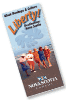 Order free Destination Liberty travel brochure
Key: (#) = number on Destination Liberty map